
Intelligence for the Backcountry
LoRELEI
Real-time tracking for the off-grid competition.
About LoRELEI
LoRELEI (Long-Range Environmental Location and Event Intelligence) is a patent pending GPS tracking system designed specifically for outdoor endurance events in areas without cellular coverage.
Using LoRa mesh networking technology, LoRELEI provides real-time tracking of runners, cyclists, and other participants across remote terrain where traditional GPS tracking solutions fail. The system supports up to 100 concurrent runners with real-time position updates.
Developed by Nein Pines for Run & Gun, competition shooting events and endurance races, LoRELEI transforms race management from reactive (manual timing, paperwork) to proactive (automated detection, real-time alerts).
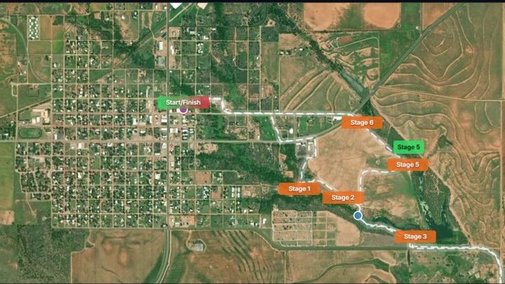
Key Features
No Cellular Required
LoRa mesh networking provides multi-mile coverage in remote areas where cell phones do not work.
Real-Time Tracking
Live position updates with automatic geofence detection for starts, stages, and finishes.
Built for Purpose
Compact devices provide 24+ hours of continuous operation on a single charge. Protected against water, dust, and impact.
Automated Scoring
Automatic checkpoint detection and timing without manual intervention. Timestamped to the second.
Safety Monitoring
Alarm zones detect off-course runners immediately. Idle detection alerts in case of injury or incapacitation.
Live Leaderboards
Real-time results display for spectators and officials. Exports for official scoring.
Contact
Interested in LoRELEI for your event?
kevin@npines.io